Facebook Utilizing AI To Map Global Population Density
Harin - Apr 10, 2019
Facebook is using AI to map population density globally. The work has humanitarian applications, but it could also benefit Facebook’s commercial interests.
- Palantir CTO Identifies Iran Conflict as First Large-Scale AI-Driven War
- Billion Dollar Blunder: Meta Shuts Down Metaverse After Wasting $80,000,000,000.00
- AI's Role in Warfare: US Strikes on Iran Unveiled
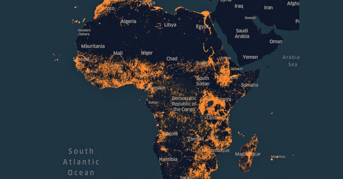
Facebook has made AI-based population maps before but not until now does it generate them on a massive scale. The social networking site is introducing ultra-detailed maps on population density that covers the major parts of Africa. The maps are created to assist relief agencies in providing aid. The technique is what the company has used before, but the formula has been changed a bit to maintain the high accuracy even with the 16 million square miles of Africa. A company blog post explained that the project would eventually map almost the whole population of the world.
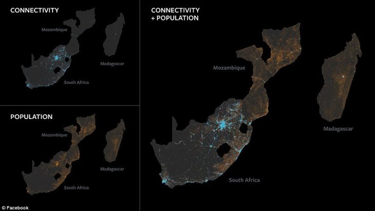
According to the giant social networking site, it is a challenging task for us humans to create maps like this. Of course, we can seek help from high-resolution imagery but turning it into high accuracy maps is going to take a lot of time and effort. For example, to generate popular density maps, humans need to label every building and cross-check with census data. This, when applied to the African continent, becomes tricky as census tracts can cover areas of up to 150,000 square miles but have only 55,000 people.
Fortunately, this kind of task is a perfect task for AI. Engineers from Facebook took data from Open Street Map, an open-source mapping project, to teach a computer vision system capable of recognizing buildings in images from the satellite. The last step is to remove the satellite data showing unoccupied land.
Facebook claims that its latest machine learning systems are faster and more accurate compared to those announced back in 2016. To generate maps for the African continent, Facebook’s programs need to go through around 11.5 billion images (each is 64x64 pixels). Researchers from Columbia University’s Center for International Earth Science Information Network also took part in the project.
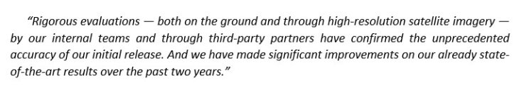
Facebook said:
The question here is, what Facebook is planning to do with all this data. In its announcement, the company has put an emphasis on humanitarian applications.
The maps will be released free of charge for the next few months. It also notes that maps like these are great tools in implementing vaccination schemes and disaster relief. The American Red Cross has already used Facebook’s data for these purposes.
Featured Stories

ICT News - Jul 29, 2026
The RAM Crisis: Graphics cards shoot up in prices again

ICT News - Jun 27, 2026
OpenAI Launches Limited GPT-5.6 Preview Amid U.S. Security Review

ICT News - Jun 16, 2026
Elon Musk Becomes World's First Trillionaire After SpaceX's Record IPO

ICT News - Jun 14, 2026
The Technological Revolution at the 2026 FIFA World Cup

ICT News - Jun 03, 2026
Apple's Liquid Metal Hinge Poised to Deliver Breakthrough for Foldable iPhone...

ICT News - May 29, 2026
New Glenn Rocket Explodes in Massive Fireball During Static Fire Test at Cape...

Mobile - May 24, 2026
iOS 27 Preview: Apple Delivers Its Most Intelligent Siri Yet Alongside Fresh AI...

ICT News - May 08, 2026
Elon Musk Highlights Neuralink Breakthrough with New Surgical Robot for Brain...

ICT News - Apr 13, 2026
DDR4 RAM Prices Finally Fall After Soaring More Than 2,200 Percent

ICT News - Apr 06, 2026
Artemis II Crew Enters Moon's Gravitational Sphere on Historic Day 5
Read more
ICT News- Jul 29, 2026
The RAM Crisis: Graphics cards shoot up in prices again
Until memory production capacity catches up, graphics cards are likely to remain more expensive than many enthusiasts hoped.
Comments
Sort by Newest | Popular