Satellite Images Could Help Predict Bridge Collapsing In the Future
Viswamitra Jayavant - Jul 24, 2019

Monitoring for structural integrity in bridges is a difficult challenge for engineers to solve. However, researchers have found a solution: using satellite images.
- India Will Use Satellites To Protect Its Land And Sea
- Tamil Nadu Engineering Student Designs The World’s Lightest Satellite
- China Testing 6G Tech After Launching World’s 1st 6G Satellite
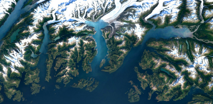
Ever since the Sputnik was launched, humanity has found quite a lot of uses for satellites. But most important to the majority of the world’s population would be their ability to capture high definition snapshots of the world, making our commute considerably easier with apps like Google Maps.
But researchers are always in the search of new applications and a joint project between NASA’s Jet Propulsion Lab and U.K.’s University of Bath has found yet another that could prove useful. By utilizing high-quality satellite imageries, it is possible for researchers to analyze the structures of bridges for minuscule movements that could signify structural weaknesses and potential failures or collapses.
The Problem
Since infrastructural projects can make or break a city’s economy, cities often conduct regular inspections, maintenance, and execute preventative measures to keep them in working order. But keeping such an operation requires a lot from the city’s available manpower and resources, even then, it is not rare for failures to occur in spite of the preventative measures.
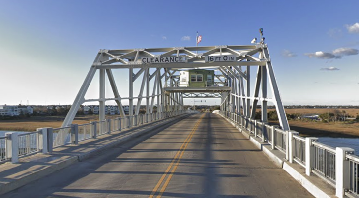
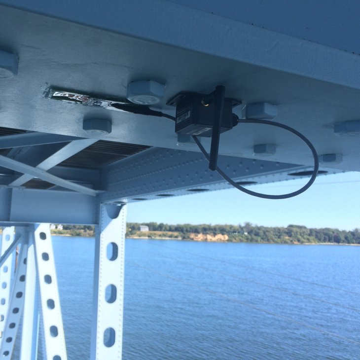
It is not until recently that the task is made a little bit easier. With the widespread application of cellular and wireless data networks as well as the proliferation of cheap computer hardware, it is not difficult to install sensors that can report the ‘health’ of the bridge to operators. While this can cut down manpower and resources greatly, it still proves tricky. Sensors only report information at the sites they were specifically installed at. And just filling up a bridge with these sensors isn’t something that is financially feasible.
An Overhead Solution
And that’s where satellite imageries come in. By replicating 3D images of a bridge gathered by overhead satellites over a long period of time, researchers were able to build an accurate model of the bridge down to a millimeter of difference in comparison to the real thing. Researchers then utilize a custom algorithm they developed to take into account all of the undesirable movements expressed by the bridge over that period of time as well as complex movements such as warping and deformation. The great thing about this is, obviously, it doesn’t require a bridge jam-packed with sensors.
Go For Practical Applications
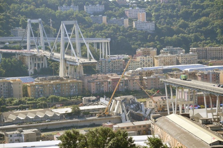
Last year in August, a portion of the Morandi Bridge in Genoa, Italy collapsed, resulting in the death of 43 people. Using this event as a reference, the researchers collected 15 years of data about the bridge, ran them all through the algorithm and found that signs of weaknesses, warping, and deformation was apparent several months prior to the ultimate tragedy. Perhaps if the tech had been fielded sooner, the accident wouldn’t have happened.
Positive results from this experiment showed that the tech can be utilized in the real world. Though the tech came far too late to be able to prevent the Morandi Bridge’s collapse, it could potentially be the protective shield from now on preventing similar tragedies from happening.
The tech relies mostly on automated software for data analyzation, and furthermore, satellite imageries are quite accessible making it easier for cities to integrate the tech into the current surveillance and maintenance workflows of bridge operators. Appropriate authorities can be alerted automatically when the algorithm detects irregular patterns that could suggest a failure before it could become serious, providing valuable time for physical assessments and remediation.
Not only for bridges, the researchers suggest that the tech could also be applied for construction projects and existing buildings that could be weakened by construction equipment. For underground projects, the tech can aid in monitoring the health of surface constructions, preventing them from collapsing as construction occurs beneath.
Featured Stories

Features - Mar 24, 2026
How to Use GeForce NOW to Play Video Games Without Actual Hardware

Features - Jan 29, 2026
Permanently Deleting Your Instagram Account: A Complete Step-by-Step Tutorial

Features - Jul 01, 2025
What Are The Fastest Passenger Vehicles Ever Created?

Features - Jun 25, 2025
Japan Hydrogen Breakthrough: Scientists Crack the Clean Energy Code with...

ICT News - Jun 25, 2025
AI Intimidation Tactics: CEOs Turn Flawed Technology Into Employee Fear Machine

Review - Jun 25, 2025
Windows 11 Problems: Is Microsoft's "Best" OS Actually Getting Worse?

Features - Jun 22, 2025
Telegram Founder Pavel Durov Plans to Split $14 Billion Fortune Among 106 Children

ICT News - Jun 22, 2025
Neuralink Telepathy Chip Enables Quadriplegic Rob Greiner to Control Games with...

Features - Jun 21, 2025
This Over $100 Bottle Has Nothing But Fresh Air Inside

Features - Jun 18, 2025
Best Mobile VPN Apps for Gaming 2025: Complete Guide
Read more

ICT News- Jun 27, 2026
OpenAI Launches Limited GPT-5.6 Preview Amid U.S. Security Review
Access remains restricted. OpenAI has not announced pricing or a timeline for broader availability.
Comments
Sort by Newest | Popular