GPS Data Helps Detect Early Signs Of Major Earthquakes
Parvati Misra - Jun 15, 2019

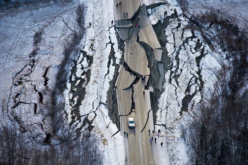
Scientists have discovered a way to identify indicators of a mega earthquake using GPS-based information, an advance that may help improve early warning systems for quakes.
- How to Fake GPS Location on iPhone or Android
- Delhi Earthquake Is Just The Beginning, Scientists Warned Indians Of A Quake Stronger Than The One In Nepal In 2015
- Indian NavIC Is More Accurate Than GPS And It Is Coming To The PublicThis Year
Scientists have figured out how to detect an early warning sign for major earthquakes. In a new press published in the journal Science Advances, scientists reported that GPS data may help early warning systems improve greatly.
The scientists from Univesity of Oregon went over data since the early 1990s and discovered a defining moment about 10 to 15 seconds into an event which could possibly signal a pending earthquake with a magnitude of 7 or higher.
GPS is used to monitor plenty of land-based faults similar to seismometer detecting the earthquake's smallest first moments.

Diego Melgar, a professor at the University of Oregon, said that thanks to GPS-based information, early warning systems could be enhanced significantly. Scientists discovered that when an earthquake in transitions into a "slip pulse," it has mechanical properties signaling magnitude. They also could identify similar trends in Chinese and European databases. On 29th May, the research was published in the journal Science Advances.
The databases have data collected from over 3,000 earthquakes. The telltale signs of displacement acceleration were identified between 10 to 20 seconds of 12 powerful earthquakes occurring from 2003 to 2016.
GPS is being used to monitor plenty of land-based, but it's not as frequently used in real-time hazard monitoring due to its delay.
He added that this delay could be improved by placing sensors on the seafloor to detect the early acceleration behavior. In doing so, the early warning systems' accuracy could be strengthened.
Featured Stories

ICT News - Feb 19, 2026
Escalating Costs for NVIDIA RTX 50 Series GPUs: RTX 5090 Tops $5,000, RTX 5060 Ti...

ICT News - Feb 18, 2026
Google's Project Toscana: Elevating Pixel Face Unlock to Rival Apple's Face ID

Mobile - Feb 16, 2026
Xiaomi Launches Affordable Tracker to Compete with Apple's AirTag

ICT News - Feb 15, 2026
X Platform Poised to Introduce In-App Crypto and Stock Trading Soon

ICT News - Feb 13, 2026
Elon Musk Pivots: SpaceX Prioritizes Lunar Metropolis Over Martian Colony

ICT News - Feb 10, 2026
Discord's Teen Safety Sham: Why This Data Leak Magnet Isn't Worth Your Trust...

ICT News - Feb 09, 2026
PS6 Rumors: Game-Changing Specs Poised to Transform Console Play

ICT News - Feb 08, 2026
Is Elon Musk on the Path to Becoming the World's First Trillionaire?

ICT News - Feb 07, 2026
NVIDIA's Gaming GPU Drought: No New Releases in 2026 as AI Takes Priority

ICT News - Feb 06, 2026
Elon Musk Clarifies: No Starlink Phone in Development at SpaceX
Read more

Mobile- Feb 17, 2026
Anticipating the Samsung Galaxy S26 and S26+: Key Rumors and Specs
The Samsung Galaxy S26 series is on the horizon, sparking excitement among tech enthusiasts.

ICT News- Feb 19, 2026
Escalating Costs for NVIDIA RTX 50 Series GPUs: RTX 5090 Tops $5,000, RTX 5060 Ti Closes in on RTX 5070 Pricing
As the RTX 50 series continues to push boundaries in gaming and AI, these price trends raise questions about accessibility for average gamers.

ICT News- Feb 18, 2026
Google's Project Toscana: Elevating Pixel Face Unlock to Rival Apple's Face ID
As the smartphone landscape evolves, Google's push toward superior face unlock technology underscores its ambition to close the gap with Apple in user security and convenience.
Comments
Sort by Newest | Popular