Three Indian Guys Developed A Pothole Detecting App
Harin - Jan 31, 2020
Dipen Babariya, Mishaal Jariwala, and Nikhil Prasad Maroli have worked together to create a pothole detecting app called RoadMetrics.
- Delhi Is The World’s Most Polluted Capital City For Three Years In A Row
- Indian Farmers Install High-Tech, Night-Vision CCTV Cameras To Protect Themselves
- Looking For The Best Electric Bike In India 2021? Take A Look At These
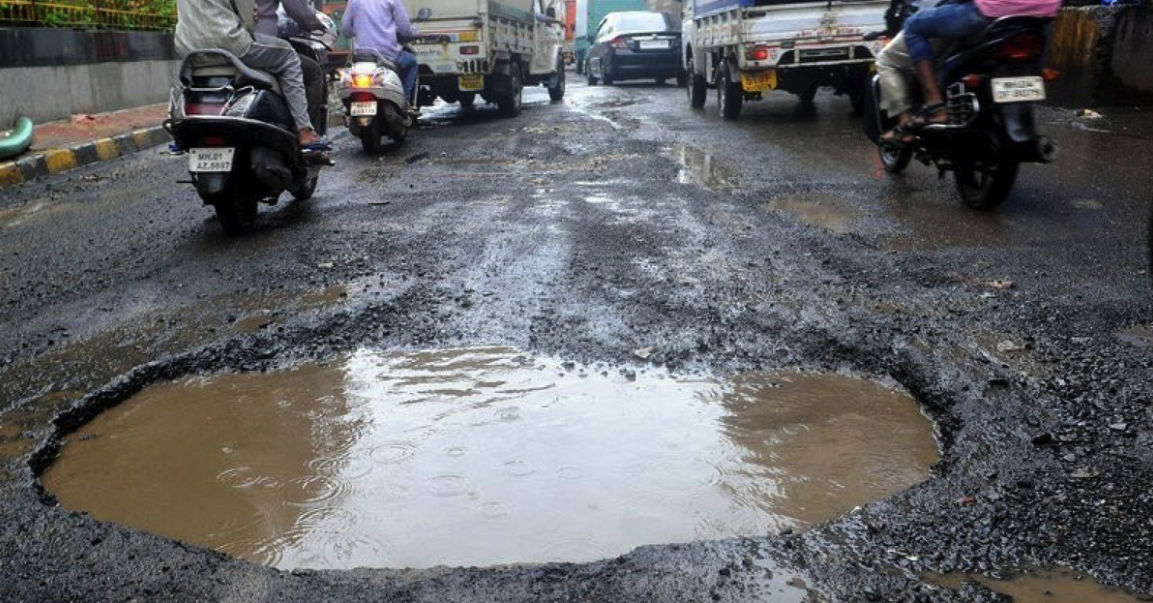
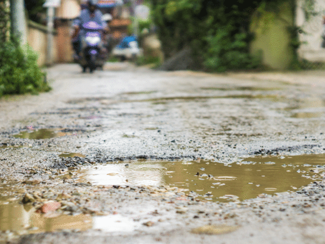
There is one thing that Indian cities and towns need to improve is their roads’ quality. No matter how many times they have fixed it, the potholes still appear, resulting in uncomfortable and dangerous journeys, especially for two-wheelers. To deal with this situation, a startup has come up with a solution.
Computer science graduate Dipen Babariya, his colleague Mishaal Jariwala, and Nikhil Prasad Maroli, an Industrial Engineering expert, have worked together to create RoadMetrics. The app detects potholes as well as cracks on the route in real-time so that people can choose a better and safer route.
While there is Google Maps, it isn’t optimized for Indian roads yet. In an interview, Dipen said that the team realized that a map needed to be created to meet Indian road conditions.
The team then take a look at the sensor data and images from their smartphones to categorize deformities. The pothole is classified by the AI algorithm like cracks, alligator, horizontal, vertical, etc, in accordance with the available data.
Mishaal Jariwala said that the team detected 12 types of deformities. They had used more than 100,000 image data points to train the algorithm, resulting in over 90% of accuracy. Sensor data (gyroscope and accelerometer) was collected for further validation to increase accuracy.
There are two variants of the app, mobile, and enterprise. For the mobile one, you can select the vehicle to have the appropriate routes suggested to you. The roads will show up in different colors to show their condition. Green means a smooth ride while Red means the opposite.
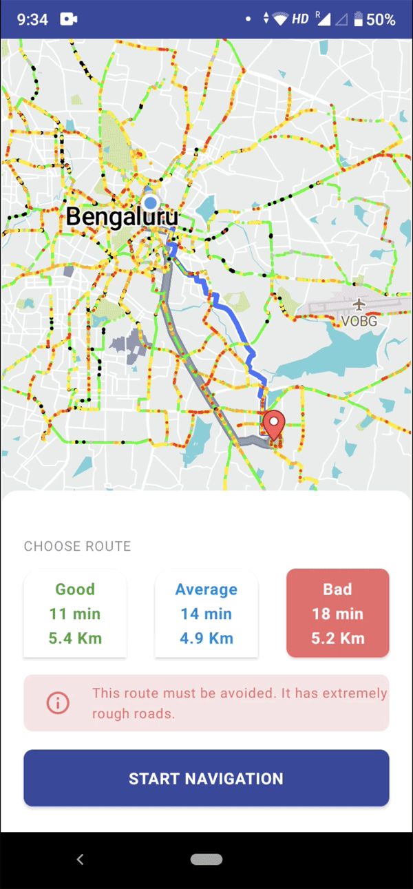
The mobile app is still in its beta stage and shows an accuracy rate of more than 90% without any human intervention.
At the moment, the app has covered around 1000 kilometers of roads around the country. The team expects that they will cover 10,000 kilometers by the end of 2020. They are working with Surat Municipal Corporation to run a pilot project of the app.
>>> Bengaluru To Use Sensor-Based Technology To Deal With Roads’ Potholes
Featured Stories

Features - Mar 24, 2026
How to Use GeForce NOW to Play Video Games Without Actual Hardware

Features - Jan 29, 2026
Permanently Deleting Your Instagram Account: A Complete Step-by-Step Tutorial

Features - Jul 01, 2025
What Are The Fastest Passenger Vehicles Ever Created?

Features - Jun 25, 2025
Japan Hydrogen Breakthrough: Scientists Crack the Clean Energy Code with...

ICT News - Jun 25, 2025
AI Intimidation Tactics: CEOs Turn Flawed Technology Into Employee Fear Machine

Review - Jun 25, 2025
Windows 11 Problems: Is Microsoft's "Best" OS Actually Getting Worse?

Features - Jun 22, 2025
Telegram Founder Pavel Durov Plans to Split $14 Billion Fortune Among 106 Children

ICT News - Jun 22, 2025
Neuralink Telepathy Chip Enables Quadriplegic Rob Greiner to Control Games with...

Features - Jun 21, 2025
This Over $100 Bottle Has Nothing But Fresh Air Inside

Features - Jun 18, 2025
Best Mobile VPN Apps for Gaming 2025: Complete Guide
Read more

ICT News- Jul 29, 2026
The RAM Crisis: Graphics cards shoot up in prices again
Until memory production capacity catches up, graphics cards are likely to remain more expensive than many enthusiasts hoped.
Comments
Sort by Newest | Popular