How Are Satellites Used For Military Purposes?
Dhir Acharya - Jun 30, 2019
Now that the availability of satellite-derived control, command, and scouting info is increasing, there’re more capabilities of satellites we can exploit.
- India Will Use Satellites To Protect Its Land And Sea
- This AI Defense System Forces Drones To Land Autonomously
- Tamil Nadu Engineering Student Designs The World’s Lightest Satellite
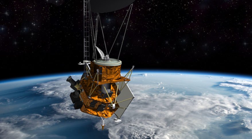
Mankind has grown its interest in space for as long as their existence on Earth. When the Soviet launched its Sputnik satellite in 1957, the space age began. Spacecraft has since had a growing important role for military than for simply satisfying human’s ambition to explore the universe.
Space, in fact, is now a crucial environment for the military because satellites are crucial ears, eyes, and nerves to fight forces. Now that the availability of satellite-derived control, command, and scouting info is increasing, there’re more capabilities of this tech we can exploit.

Orbital characteristic
The orbit of a satellite is usually elliptical with the Earth’s center at one of the focuses of the ellipse. There are a few factors describing the shape, size, and orientation of a satellite’s orbit in space, including the argument of the perigee, the orbital inclination, the right ascension of the ascending mode, the time of perigee passage, and the semi-major axis and eccentricity of the orbit.
Satellites in orbit
There are three categories of satellite orbits, namely: LEO (Low Earth Orbits) which is between 150 and 1,500 kilometers, Medium Altitude Orbits which are between 1,500 and 35,800 kilometers, and High Altitude Orbits which are from 35,800 kilometers and beyond.
Applications of satellites in military
Military forces launch several kinds of satellites every year; however, there are three most important types, including navigation, communication, and reconnaissance. Together, these three form part of the whole warning and information system.
Surveillance
To perform surveillance missions all over the world, only space-based sensors can provide continuous and complete coverage. Currently, there are three surveillance missions being performed in space, including:
Early Warning: These sensors are located in geosynchronous orbit, capable of giving warnings against submarine or intercontinental ballistic missile attack. Such systems sense the height of the missile through the atmosphere, then they add critical records to a strategic warning as well as validate information through the use of early warning system on land.
Nuclear Detonation: The sensors are mounted on satellite and can automatically detect nuclear explosions as well as determine the location of the occurring and essential info for strategic strike assessment.
Weather Monitoring: Thanks to satellite weather coverage, we can know the weather condition at any location on Earth in real time. We can also forecast weather from photographs. As usual, strategic weather info is gathered from geosynchronous satellites and it’s best to obtain detail tactical weather data from satellites in low sub-synchronous orbit. Sea and wind state can be invaluable to tactical commanders, helping them effectively deploy forces.
Reconnaissance
Military reconnaissance is similar to surveillance, except that it focuses on collecting detailed info of a specific nature. In strategic terms, space-based sensors can be tasked with observing the enemy’s development of weapons, aiding in strategic targeting, as well as verifying compliance to arms limitations treaties.

Before and during armed conflict, satellites are able to detect deployments of air, sea, and land forces. We can use intelligence info from satellites as a force multiplier to the commanders. It’s the most important for the commander to know where the enemy is, as well as what he’s doing and how strong he is. These types of information are also decisive factors in battle.
Military reconnaissance
There are four types of Military reconnaissance satellites: Photographic Reconnaissance Satellites, Electronic Reconnaissance Satellites, Ocean Surveillance Satellites, and Early Warning Satellites.
The Photographic type serves from around 200km from Earth’s surface. These satellites have two tasks, Area Surveillance in which they scan an area for objects of potential military interest with a low-resolution wide-angle camera; and Close-look Photographic Reconnaissance in which they use a high-resolution camera to view a narrow field and re-photograph those of particular interest. The Close-look process is done during the Area mission.
The Electronic type, on the other hand, acts as space-based ears and houses equipment used for detecting and monitoring radio signals produced by military activities of the enemy. These satellites monitor signals generated from military communications taking place between bases from missile defence and air defence radars, warning radars, or from communications used for missile control.

By using the satellites, we can locate systems that produce electromagnetic signals and may make plans for defence through analysis of the signals’ characteristics and essential data. To do this, four satellites with four receivers will locate an unknown transmitter’s position on the surface of the Earth; this kind of mission should be conducted at an altitude of between 480 and 650 kilometers.
The Ocean Surveillance type includes two kinds of satellites used to monitor the ocean. While the first one – ocean surveillance satellites are responsible for detecting and tracking military surface ships, the second one – oceanographic satellite, determines various properties of the ocean. These satellites are usually put at around 500 kilometers from the Earth surface.
Last but not least, the Early Warning type detects enemy missiles right at the moment they’re launched, helping extend the warning time for defence. Early warning satellites use sensors which are sensitive to infrared radition, which is emitted from military targets and varies at different degrees, to detect the targets.
Military communication

This is one of the greatest application of satellites. Satellites in military use SHF (7.2-8.4GHz) and UHF (9225-3400MHz), sharing these with terrestrial systems as well as other satellites. Military satellite communication also uses other bands such as 40/60 GHz, 30/20 GHz, and 14/11 GHz. With higher frequency bands, we have enhanced traffic which increases protection from jamming as well as a lower probability of intercepting transmissions from covert terminals. Satellite communication system comes with several advantages, including:
One satellite can cover a large geographical communication.
Satellite transponders feature large transmission capacities, which means support for high data rates.
The inherent flexibility is beneficial for remote control and less vulnerability to direct attack.
Being physically remote, they are less vulnerable to direct attack.
Featured Stories

Features - Dec 18, 2024
6 Cutting-Edge Features of Galaxy AI & Lineup of Supported Samsung Smartphones

Features - Jan 23, 2024
5 Apps Every Creative Artist Should Know About

Features - Jan 22, 2024
Bet365 India Review - Choosing the Right Platform for Online Betting

Features - Aug 15, 2023
Online Casinos as a Business Opportunity in India

Features - Aug 03, 2023
The Impact of Social Media on Online Sports Betting

Features - Jul 10, 2023
5 Most Richest Esports Players of All Time

Features - Jun 07, 2023
Is it safe to use a debit card for online gambling?

Features - May 20, 2023
Everything You Need to Know About the Wisconsin Car Bill of Sale

Features - Apr 27, 2023
How to Take Advantage of Guarantee Cashback in Online Bets

Features - Mar 08, 2023
Comments
Sort by Newest | Popular