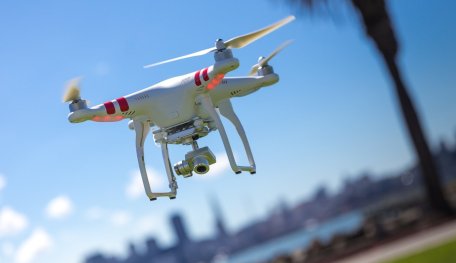
Survey Of India To Digitally Map The Country With Drones, AI, And Big Data
Aadhya Khatri

The Survey of India has taken up this task of mapping the entire country with the help of big data and AI
- Delhi Is The World’s Most Polluted Capital City For Three Years In A Row
- Indian Farmers Install High-Tech, Night-Vision CCTV Cameras To Protect Themselves
- Looking For The Best Electric Bike In India 2021? Take A Look At These
According to a senior government official, India has plans to digitally map the entire country with a resolution of up to 10 centimeters, with support from technologies like big data and AI.
This challenging task is assigned to the Survey of India, which is part of the Department of Science and Technology a few months back. The initial plan is for the task to be done in two years. This information was shared by Prof Ashutosh Sharma, the Department's Secretary.

Once the mapping is done, all the data will be made public to local bodies, Gram Panchayats, and citizens, encouraging them to use it in the process of planning and decision making.
The project is now working in the Ganga basin, Karnataka, Maharashtra, and Haryana.
He emphasized the importance of having an accurate digital map, saying that such a map would serve as the foundation for everything relating to planning and development like setting up schools, hospitals, or building train tracks.
He also said that the ISRO (Indian Space Research Organisation) did not participate in this project. The reason for this is the mapping based on drones, and they also took curvature into consideration.
He also shared that Survey of India had a reference point set up every 20 km. These points would serve as digital stations with well-established coordinates. With this system in place, even with a smartphone, you could have a map with an accuracy of 10 cm.
He also drew a difference between GPS and a digital map. While GPS can only have an accuracy of a few meters, the map India is making can increase that rate manifold.
Featured Stories
Features - Feb 26, 2025
Elon Musk Eyes Indian Market: Tesla’s Next Big Move?
Features - Aug 03, 2023
The Impact of Social Media on Online Sports Betting
Features - Jul 10, 2023
5 Most Richest Esports Players of All Time
Features - Jun 07, 2023
Is it safe to use a debit card for online gambling?
Features - May 20, 2023
Everything You Need to Know About the Wisconsin Car Bill of Sale
Features - Apr 27, 2023
How to Take Advantage of Guarantee Cashback in Online Bets
Features - Mar 08, 2023
White Label Solutions for Forex
Review - Jul 15, 2022
WHY BETTING SIGNUP OFFERS ARE IMPORTANT FOR NEW GAMBLERS
Mobile - Jul 01, 2022
The Best Sports Video Games to Play in 2022
Features - Apr 28, 2022