Mysterious Places That Are Blurred Out On Google Maps
Harin - Dec 29, 2020
For mostly unexplained reasons, there are places that are hidden on Google Maps, that users are not allowed to see. Here are some of them.
- You Can Now Know Your Exact Location With Google's Live View
- Google Maps Helps You Find Food And Night Shelters Across 30 Cities Amid CO.VID-19
- A Man Blames Google Maps For Making Him Fall Into A Ice Lake
Google Maps has long become an indispensable tool for people when they need to look for directions. However, it also hides secret locations that we can only guess what they are for.
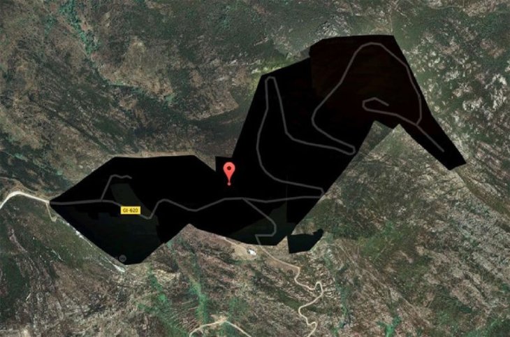
Jeannette Island – Russia
Jeannette island is quite small. It is in the east of the Siberian Sea. The total length of the island is only about 2km. Nearly the entire island is frequently covered with ice, with a 350mm-high peak in the center. Perhaps the reason why it is blacked out on Google Maps is because of the dispute over sovereignty between Russia and the US.
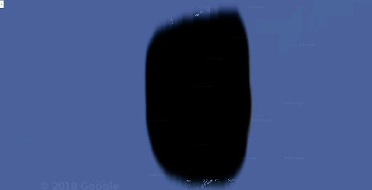
Girona Province, Spain
Located in northeastern Spain, Girona borders the autonomous community Catalunya, the provinces of Barcelona and Lleida, as well as France and the Mediterranean. On Google Maps, you can see a mysterious black zone in the northeastern part of the province. There is no prominent place around except for a few streets. However, there is a hotel in that black space called Roses. People say that this place is probably a resort for the rich and famous. It has been kept hidden to avoid the curious eyes of outsiders.
Munitiecomplex, Veenhuizen, the Netherlands
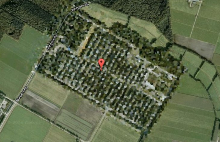
The government of the country is hiding important areas on the map. This square piece of land that looks like an oil painting from above is actually an ammunition warehouse of the Dutch army.
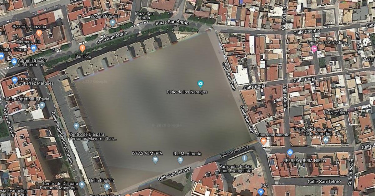
Patio de los Naranjos – Spain
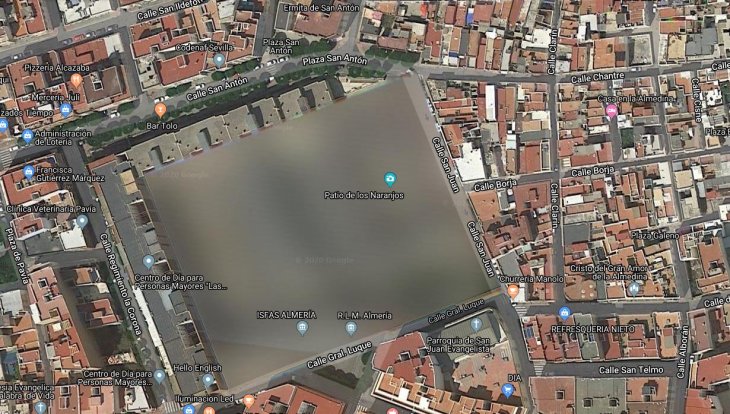
Patio de Los Naranjos is a square campus located in the Spanish city of Almeria. According to some people, the place is related to new government projects built for important purposes.
Mururoa Island – Polynesia
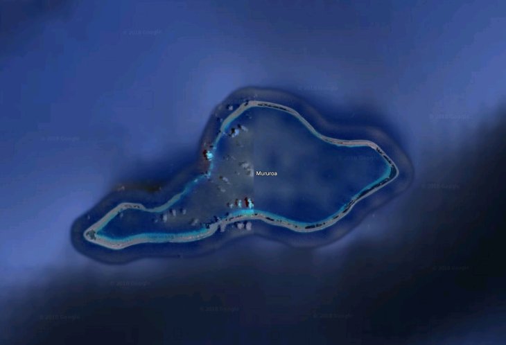
Mururoa is a coral island in the Polynesian archipelago located in the Pacific Ocean, owned by the French Republic. Google Maps never shows a clear image of the island. And no one knows the reason why.
However, there are some hypotheses suggesting that the reason is related to the history of the island, which was used for nuclear testing by France. From 1966 to 1996, 181 trials were conducted here.
Featured Stories

Features - Mar 24, 2026
How to Use GeForce NOW to Play Video Games Without Actual Hardware

Features - Jan 29, 2026
Permanently Deleting Your Instagram Account: A Complete Step-by-Step Tutorial

Features - Jul 01, 2025
What Are The Fastest Passenger Vehicles Ever Created?
Features - Jun 25, 2025
Japan Hydrogen Breakthrough: Scientists Crack the Clean Energy Code with...

ICT News - Jun 25, 2025
AI Intimidation Tactics: CEOs Turn Flawed Technology Into Employee Fear Machine

Review - Jun 25, 2025
Windows 11 Problems: Is Microsoft's "Best" OS Actually Getting Worse?

Features - Jun 22, 2025
Telegram Founder Pavel Durov Plans to Split $14 Billion Fortune Among 106 Children

ICT News - Jun 22, 2025
Neuralink Telepathy Chip Enables Quadriplegic Rob Greiner to Control Games with...

Features - Jun 21, 2025
This Over $100 Bottle Has Nothing But Fresh Air Inside

Features - Jun 18, 2025
Best Mobile VPN Apps for Gaming 2025: Complete Guide
Read more

ICT News- Jul 29, 2026
The RAM Crisis: Graphics cards shoot up in prices again
Until memory production capacity catches up, graphics cards are likely to remain more expensive than many enthusiasts hoped.
Comments
Sort by Newest | Popular