IIT Kharagpur Developing Maps To Reduce Damage Caused By Earthquakes
Anita - Jan 01, 2019
IIT Kharagpur's scientists are developing city-level maps to identify areas that are most likely to be affected by quakes to timely send in rescue and relief teams.
- IIT Mandi Researchers Develop Road That Can Generate Electricity By Walking
- IIT-Guwahati Is Working On An Antimicrobial Coating For PPE
- IIT Guwahati Develops A Low-Cost Machine To Sanitize Hospitals And Buses Floors
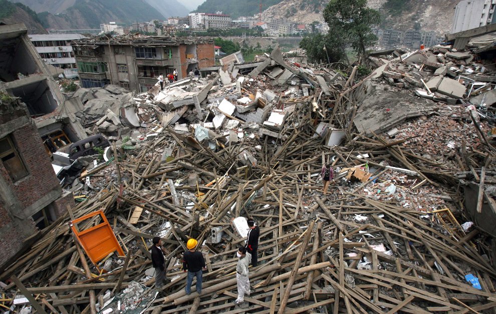
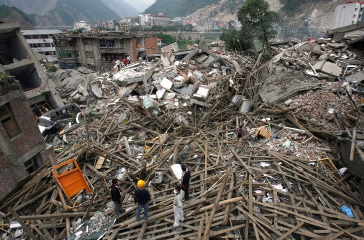
Maps which can offer detailed information to recognize the most likely affected areas from an earthquake are being developed by IIT Kharagpur’s scientists. The study is expected to assist state governments in identifying high-risk areas quickly to send in rescue as well as relief teams in case that a natural disaster hits, eliminating the step to survey affected area manually.
According to West Bengal-based IIT Kharagpur’s Prof. Sankar Kumar Nath, "Saving time during a disaster is important because time is life."
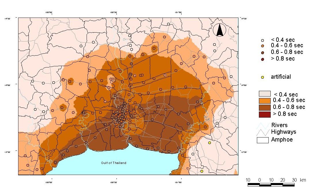
Nath presented his study at the 16th Symposium on Earthquake Engineering conference, which was held at IIT Roorkee of Uttarakhand in coordination with the Indian Society of Earthquake Technology. Seismic microzonation is defined as the process including presenting different factors like soil quality, plate tectonics, topography, building types, equations of ground motion in the form of map to get knowledge about which areas in a city may be affected the most by an earthquake. This technique also considers secondary risks like floods, landslides which are possible to occur due to the impact of quakes.
In an interview with PTI, Nath said:
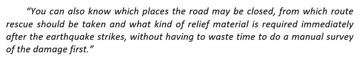
The system can assist the state governments in estimating the needed fund for rescue as well as rehabilitation. For instance, Kolkata city may suffer losses as much as 231 million if an earthquake happens.
The above figure does not include the losses of essential facilities like schools, hospitals. Otherwise, the losses can reach up to around 500 million.
Nath said that in India, the minimum number of citizens who are at high risk of being affected by earthquakes in the Himalayan region is one million people. IIT Kharagpur is one of the institutes involved in the Expression of Interest for seismic microzonation of the Ministry of Earth Sciences which prioritize eight cities such as Meerut, Patna, Agra, and Amritsar. An auction for microzonation of several cities is planned to be conducted by the institute. IIT Delhi, IISc - Indian Institute of Science Bangalore, and IIT Roorkee are said to be among the list of participants in this auction which is expected to close on the 15th of January.
Featured Stories

Features - Mar 24, 2026
How to Use GeForce NOW to Play Video Games Without Actual Hardware

Features - Jan 29, 2026
Permanently Deleting Your Instagram Account: A Complete Step-by-Step Tutorial

Features - Jul 01, 2025
What Are The Fastest Passenger Vehicles Ever Created?

Features - Jun 25, 2025
Japan Hydrogen Breakthrough: Scientists Crack the Clean Energy Code with...

ICT News - Jun 25, 2025
AI Intimidation Tactics: CEOs Turn Flawed Technology Into Employee Fear Machine

Review - Jun 25, 2025
Windows 11 Problems: Is Microsoft's "Best" OS Actually Getting Worse?

Features - Jun 22, 2025
Telegram Founder Pavel Durov Plans to Split $14 Billion Fortune Among 106 Children

ICT News - Jun 22, 2025
Neuralink Telepathy Chip Enables Quadriplegic Rob Greiner to Control Games with...

Features - Jun 21, 2025
This Over $100 Bottle Has Nothing But Fresh Air Inside

Features - Jun 18, 2025
Comments
Sort by Newest | Popular